Skip to Content

Internet of Things

Starter Kit

Solution benefits

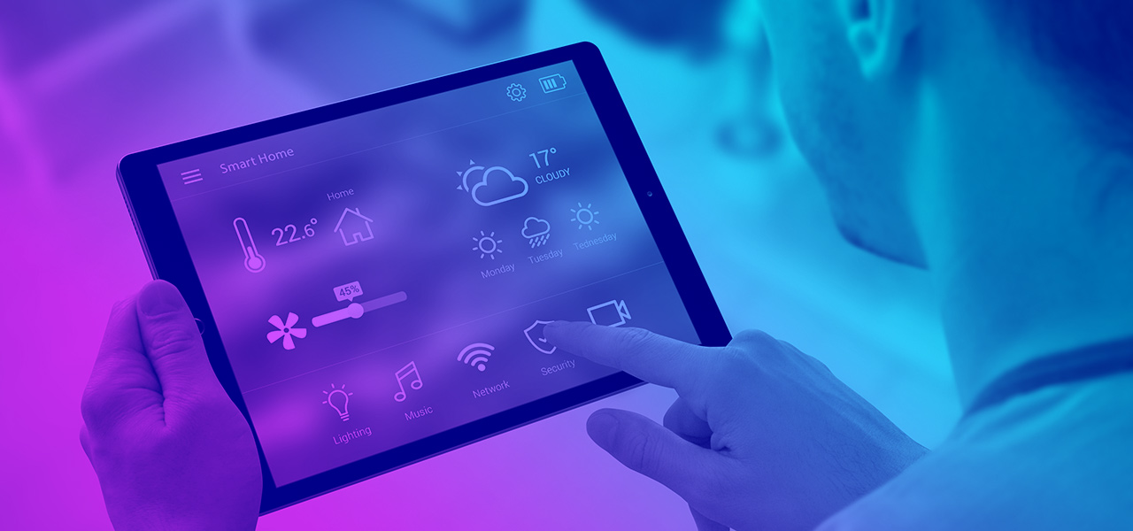
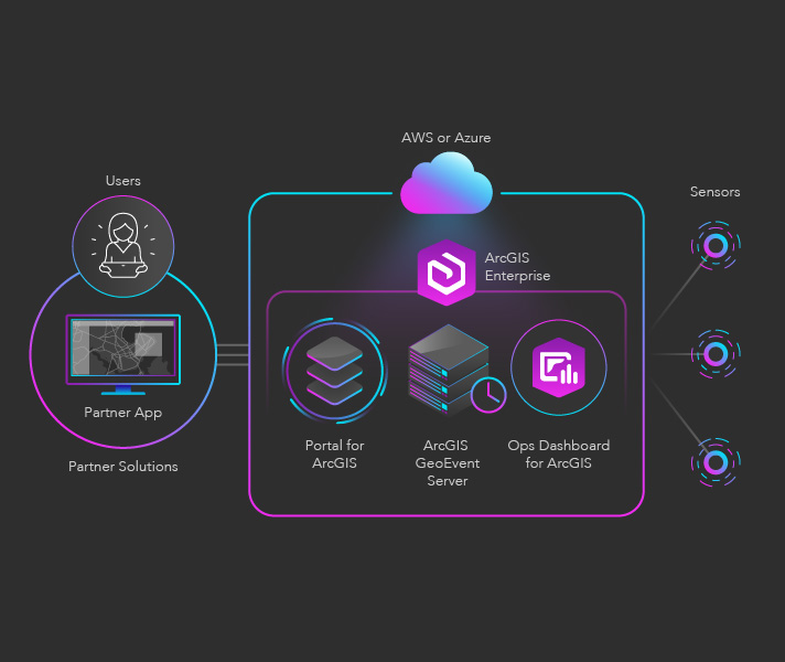
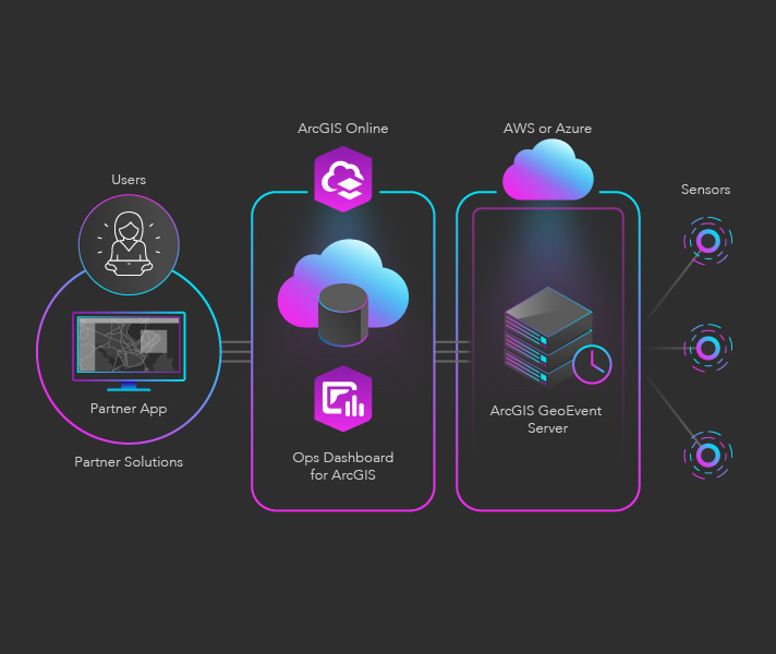
Location is a crucial facet of Internet of Things (IoT) IoT data. In systems with billions of connected sensors providing vast quantities of data in real time, it is critical for organizations to have solutions that can analyze this data, discover patterns, and provide new insight.

IoT solutions ingest, process, analyze, and visualize thousands to millions of events per second, giving decision-makers and stakeholders the insights they need to drive immediate and future ideas and strategies. These solutions take the high-velocity, high-volume data of IoT and brings it to life, revealing patterns, connections, and opportunities that are otherwise difficult—or impossible—to decipher. This delivers a faster, next generation level of decision-making and problem solving.

Capabilities utilized

2D/3D maps
Data hosting
Spatial analysis
IoT and real-time analytics

Use cases

Previous
Next

Conceptual architecture

Description of components

  • ArcGIS Enterprise: A complete GIS that runs behind your firewall in your enterprise or on cloud infrastructure like AWS or Azure
  • ArcGIS GeoEvent Server: A server that connects to sensors and data streams, captures real-time data, and processes and filters important events
  • Operations Dashboard for ArcGIS: A configurable web app that provides a real-time operational view of assets through visualization, analytics, and key performance indicators
  • Partner Solutions: Custom web, mobile, and desktop apps that enable advanced data visualizations, built using ArcGIS development APIs and SDKs

Description of components

  • ArcGIS Enterprise: A complete GIS that runs behind your firewall in your enterprise or on cloud infrastructure like AWS or Azure
  • ArcGIS GeoEvent Server: A server that connects to sensors and data streams, captures real-time data, and processes and filters important events
  • ArcGIS Online: A complete cloud-based mapping and analysis platform
  • Operations Dashboard for ArcGIS: A configurable web app that provides a real-time operational view of assets through visualization, analytics, and key performance indicators
  • Partner Applications: Custom web, mobile, and desktop apps that enable advanced data visualizations, built using ArcGIS development APIs and SDKs

Was this starter kit useful?

Let us know how to improve our starter kits.

Send feedback