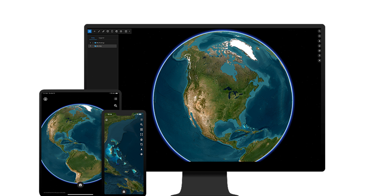
ArcGIS Earth is a free application designed for visualizing and exploring geospatial content in 3D on desktop and mobile devices. Collaborate and plan with stakeholders on an interactive 3D globe, both online and offline, to gain situational awareness. ArcGIS Earth supports a wide array of data formats and services, including KML, scene layers, 3D Tiles, map packages, tile packages, and Open Geospatial Consortium (OGC) web services.
Powered by intuitive and multidimensional insights, ArcGIS Earth enables users to monitor operations in 3D, quickly sense and comprehend an environment, and improve decision-making.
Access a PDF of this web page
Benefits of ArcGIS Earth
ArcGIS Earth is a secure and adaptable application that delivers a comprehensive solution for data collaboration, research, planning, and time-sensitive briefings.
3D-first design
Works in any environment
Gain multidimensional insight
Create, edit, and share
Highly customizable experience
3D-first design
Visualize your data or explore ArcGIS Living Atlas of the World on an interactive 3D globe. Utilize exploratory analysis tools to conduct measurements, create an elevation profile, and conduct an interactive line of sight and viewshed analysis to inform operations. Symbolize feature layers with the single-symbol and dictionary methods, including military symbology, for stronger graphic presentation.
Work in any environment
Access critical data online and offline. ArcGIS Earth supports network-resilient and adaptable workflows for use in the office or on-site. Inform and validate decisions with 3D exploratory analysis tools across desktop and mobile devices.
Gain multidimensional insight
ArcGIS Earth extends capabilities beyond traditional two-dimensional workflows. As the volume and velocity of data continues to increase exponentially, our ability to intuitively interpret data becomes a challenge. Viewing and exploring complex data on a 3D globe provides familiar context, which better aligns with how we naturally perceive and understand information.
Create, edit, and share KML
ArcGIS Earth enables all users to work with KML, KMZ, and KML network links in their entirety. Regardless of user type or connectivity, users can create, edit, and share KML with the latest OGC specifications. Manipulating KML layer properties, styles, and labels is supported for all geometry types.
Highly customizable user experience
Use the configuration file to customize the ArcGIS Earth user experience. These settings can be applied for an individual user or applied throughout an entire organization. Seamlessly integrate access to web-based applications, experiences, and surveys in ArcGIS Earth, or automate your workflows with the ArcGIS Earth Automation API.
How it works
Explore anywhere on the globe
Explore ArcGIS Living Atlas, the world’s foremost collection of geographic information. Or, bring your own maps, scenes, and digital twin assets to the globe to explore an area of interest.
Explore ArcGIS Living Atlas
Interact in 3D
Use interactive line of sight, viewshed, and 3D measurement tools to better understand natural and urban landscapes and perform visibility analysis. Whether you are planning a security operation or monitoring the effects of human encroachment on biodiversity, ArcGIS Earth provides an accessible way to unite, interact, and engage.
Sketch, annotate, and measure
Draw and edit placemarks, paths, and polygons. Add annotations and operational data. Measure coordinates and the distance between 3D points on a map.
Style with symbology and labels
Symbolize feature layers, including support for layer styles and data dictionary-driven symbology. Symbolize KML with the included symbol library, a style URL, or with your own custom symbols. Whether you are working with features or KML layers, ArcGIS Earth gives you the ability to label all geometry types for creating dynamic, standardized decision aids.
Communicate and share
Save and share your KML/KMZ files with collaborators to use in connected and disconnected environments on desktop or mobile devices. Access and share data through mechanisms such as workspaces or QR codes.
Case Study
Monitoring pipelines with ArcGIS Earth
Kinetik, a midstream operator, uses ArcGIS Earth to create a streamlined method for engineers to edit, sync, and share files containing pipeline data.
Read the case study
Visualize, analyze, and share data across devices and environments
ArcGIS Earth mobile extends the capabilities of the desktop version. Browse geospatial content to visualize data on a 3D globe, see 3D data in augmented reality (AR), collect and share GPS tracks, and perform 3D analysis. Download ArcGIS Earth for desktop and mobile for free.
Desktop app
Get the newest version of ArcGIS Earth for desktop.
Download ArcGIS Earth for Windows
Mobile apps
Get the newest version of ArcGIS Earth for mobile.